
Japanese Territory
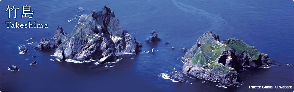
Takeshima Immediately After World War II
The Supreme Commander for the Allied Powers (SCAP) designated the areas where Japan had to cease exerting political and administrative power and the areas where it was restricted from engaging in fishing or whaling, which included Takeshima. These directives, however, stated that they should not be construed as an indication of Allied policy relating to the ultimate determination of the assignment of Japanese sovereign territory.
The descriptions in the related Supreme Commander for the Allied Powers Instruction Note (SCAPIN) are as follows:
(1) SCAPIN No. 677
(a) In January 1946, SCAP issued SCAPIN No. 677 to instruct Japan to provisionally cease exerting or attempting to exert political or administrative power over some areas.
(b) Paragraph 3 of the note states, “For the purpose of this directive, Japan is defined to include the four main islands of Japan (Hokkaido, Honshu, Kyushu and Shikoku) and the approximately 1,000 smaller adjacent islands, including the Tsushima Islands and the Ryukyu (Nansei) Islands north of 30 degrees North Latitude (excluding Kuchinoshima Island)” and listed Utsuryo Island, Cheju Island, the Izu Islands, the Ogasawara Islands, and Takeshima as the areas not included with those where Japan was allowed to exert political or administrative power.
(c) Paragraph 6 of the same note, however, clearly states that “[n]othing in this directive shall be construed as an indication of Allied policy relating to the ultimate determination of the minor islands referred to in Article 8 of the Potsdam Declaration.” (Potsdam Declaration, Article 8: “Japanese sovereignty shall be limited to the islands of Honshu, Hokkaido, Kyushu, Shikoku and such minor islands as we determine.”)
(2) SCAPIN No. 1033
(a) In June 1946, SCAP issued SCAPIN No. 1033 to expand the areas where Japanese were permitted to engage in fishing and whaling (the “MacArthur Line”).
(b) Paragraph 3 of the note states “Japanese vessels or personnel thereof will not approach closer than twelve (12) miles to Takeshima (37°15' North Latitude, 131°53' East Longitude) nor have any contact with said island.”
(c) Paragraph 5 of the same instruction note, however, states that “[t]he present authorization is not an expression of allied [sic] policy relative to [the] ultimate determination of national jurisdiction, international boundaries or fishing rights in the area concerned or in any other area.”
The abolishment of the “MacArthur Line” was directed in April 25, 1952, and three days after, on April 28, the San Francisco Peace Treaty came into effect, which consequently nullified the directive to cease Japan's political and administrative power in the aforementioned areas.
The ROK claims that the Allies did not recognize Takeshima as part of Japan's territory based on the SCAPIN documents mentioned above, and includes them in the evidence for its claim of sovereignty over Takeshima. However, both of the SCAPIN documents clearly state that they shall not be construed as an indication of Allied policy relating to the ultimate determination of the assignment of Japanese sovereignty, and therefore such claims are obviously incorrect.
The territory of Japan was determined by the San Francisco Peace Treaty when it subsequently came into effect. This clearly shows that none of the treatment of Takeshima prior to the effect of that Treaty affects the title to Takeshima.
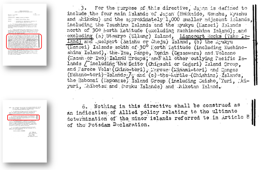
▲SCAPIN No. 677
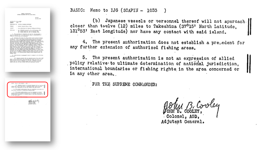
▲SCAPIN No.1033