Global Mapping Partnership
- Sustainable Development and Geographic Information -

At this event, speakers emphasized the importance of enhancing international partnership in order to achieve sustainable development through wise usage of geographic information, especially with Global Mapping data. Global Mapping is a registered Type 2 initiative to develop Global Map (digital geographic information with unified specifications) for whole terrestrial Area by 2007.
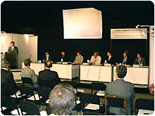
This event was co-organized by the Ministry of Land, Infrastructure and Transport (MLIT), Japan and the International Steering Committee for Global Mapping (ISCGM). It started with a keynote speech by Mr. Shizuo Sato, Senior Vice-Minister of Land, Infrastructure and Transport and followed by presentations of seven panelists. Lastly open discussion was done actively among panelists and the audience. Due to time limitation the discussion has to be terminated.
Mr. Shizuo Sato, Senior Vice-Minister of Land, Infrastructure and Transport, Japan, outlined that the aim of global mapping is to establish globally consistent data sets of geographic information to evaluate and address global environmental problems. He introduced that Global Mapping is mentioned in the Implementation Plan of World Summit on Sustainable Development and that Global Mapping is a Type 2 initiative aiming at enhancing international partnership and completion of Global Map before 2007. He called for further participation in the Global Mapping to all countries.
Mr. Toru Nagayama, MLIT, introduced results of a study for applying Global Map data for forecasting agricultural yield, water resource availability and others using models and simulation techniques. This showed the usefulness of Global Map data for these analyses.
Mr. Derek Clarke, Chief Director, Surveys and Mapping of South Africa, outlined the role of national mapping organizations for global mapping and its applications in developing countries especially in African countries, highlighting usefulness in the fields of land-use inventory, land-use change, environmental impact analysis, food security and development planning. He outlined challenges, including a lack of recognition of the importance of global mapping, lack of institutional coordination, and duplication of efforts. He also introduced Global Map of South Africa.
Dr. Milan Konecny, Vice-President of International Cartographic Association, discussed how global mapping data can be a useful tool for decision making for sustainable development in a context of information society. He gave various images and examples including recent flood in central Europe as applications of geographic information and GIS.
Dr. Timothy Foresman, Executive Science Advisor, United Nations Environment Programme, talked about applications of geographic information for global environmental issues with various examples and showed the importance of providing geographic information for understanding global environmental issues and taking appropriate measures.
Mr. Yuji Osawa, National Space Development Agency of Japan (NASDA) described the main features and characteristics of the Advanced Land Observation Satellite to be launched in 2004 and emphasized the cost effectiveness of the satellite technology for mapping.
Dr. John Kelmelis, Chief Scientist for Geography, US Geological Survey, explained about the new initiative of "Geographic Information for Sustainable Development" and talked about the possible collaboration with Global Mapping. He described phase 2 plan of Global Mapping with increased resolution that is applicable not only global issues but also local issues. He emphasized Japan's contribution to these important global issues and also USA's contribution providing data to these projects. This forms a part of international partnerships and collaboration.
Minoru Akiyama, Secretary-General of the ISCGM, introduced various global and regional initiatives relating to geographic information and talked the importance of collaborations with these initiatives for the Global Mapping Project.
Back to Index
